


1-1 Puryear Voting District, Henry County, Tennessee
About
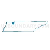
Outline

Summary
| Unique Area Identifier | 668846 |
| Name | 1-1 Puryear Voting District |
| County | Henry County |
| State | Tennessee |
| Area (square miles) | 83.13 |
| Land Area (square miles) | 83.08 |
| Water Area (square miles) | 0.05 |
| % of Land Area | 99.94 |
| % of Water Area | 0.06 |
| Latitude of the Internal Point | 36.45893040 |
| Longtitude of the Internal Point | -88.35575520 |
Maps


Graphs
Select a template below for downloading or customizing gragh for 1-1 Puryear Voting District, Henry County, Tennessee


Neighbors
Neighoring Voting District (by Name) Neighboring Voting District on the Map
- 01A Palmersville Volunteer Fire Dept. Voting District, Weakley County, TN
- 1-2 Cottage Grove Voting District, Henry County, TN
- 1-3 Buchanan Voting District, Henry County, TN
- 4-1 City Hall Voting District, Henry County, TN
Top 10 Neighboring County Subdivision (by Population) Neighboring County Subdivision on the Map
- District 1, Henry County, TN (6,288)
- District 4, Henry County, TN (6,265)
- District 1, Weakley County, TN (3,679)
- New Concord CCD, Calloway County, KY (3,458)
- Hazel-Lynn Grove CCD, Calloway County, KY (3,277)
- Sedalia CCD, Graves County, KY (2,905)
Top 10 Neighboring Place (by Population) Neighboring Place on the Map
Top 10 Neighboring Unified School District (by Population) Neighboring Unified School District on the Map
- Weakley County School District, TN (35,021)
- Graves County School District, KY (27,496)
- Calloway County School District, KY (26,537)
- Henry County School District, TN (20,665)
Top 10 Neighboring State Legislative District Lower Chamber (by Population) Neighboring State Legislative District Lower Chamber on the Map
- State House District 75, TN (62,143)
- State House District 76, TN (55,610)
- State House District 5, KY (41,952)
- State House District 2, KY (41,936)
Top 10 Neighboring State Legislative District Upper Chamber (by Population) Neighboring State Legislative District Upper Chamber on the Map
Top 10 Neighboring 111th Congressional District (by Population) Neighboring 111th Congressional District on the Map
Top 10 Neighboring Census Tract (by Population) Neighboring Census Tract on the Map
- Census Tract 9696, Henry County, TN (7,898)
- Census Tract 9690, Henry County, TN (4,389)
- Census Tract 108, Calloway County, KY (3,458)
- Census Tract 107, Calloway County, KY (3,277)
- Census Tract 204, Graves County, KY (2,905)
- Census Tract 9691, Henry County, TN (2,796)
- Census Tract 9692, Henry County, TN (1,831)
- Census Tract 9687, Weakley County, TN (1,484)
- Census Tract 9680, Weakley County, TN (1,177)
Top 10 Neighboring 5-Digit ZIP Code Tabulation Area (by Population) Neighboring 5-Digit ZIP Code Tabulation Area on the Map
- 38242, TN (20,151)
- 38251, TN (2,751)
- 38222, TN (2,629)
- 42049, KY (1,480)
- 38224, TN (956)
- 38241, TN (898)